

Located east of Vaseux Lake, Eagle Bluff and Ocher Cliff hiking area offer an impressive duo of high-points to ascend - each offering a nearly 360 degree view of the surrounding area.
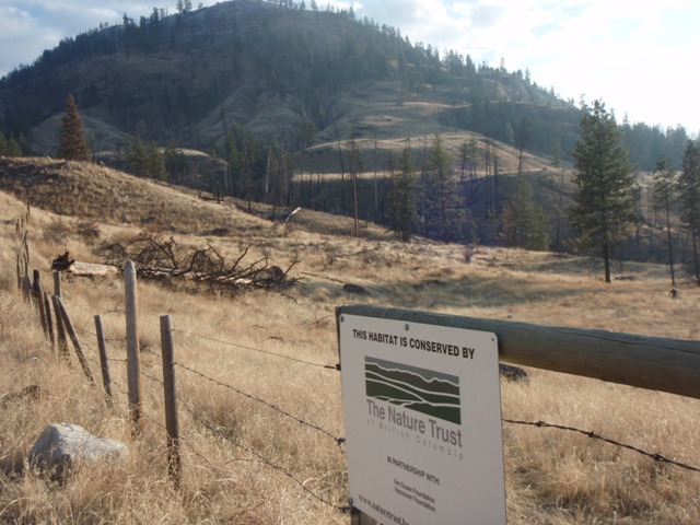
The area is accessed by driving six kilometers south of downtown Okanagan Falls on Highway 97, turning left onto McIntyre Creek Road, then driving a further 2.4 kilometers to a small pull-off to the right, immediately adjacent to a Nature Trust sign; park, read & learn.
On that note; this trail is located on a combination of Crown, Crown Conservation and Nature Trust land. It's also host to an important Rocky Mt. Bighorn Sheep population in the Okanagan Valley. Needless to say - but I'll say it anyway - leave Fido at home, leave your bike at home, leave your horse at home :-) This is hike-only territory.
There you’ll see a barbed wire fence with manual latch system and a grassy field beyond. The hike begins with a stroll across this field, following a vague path through the grass until you reach a "small irrigation creek" (its actual title). Cross it and climb the small embankment on the other side - this is likely the most precarious crossing of the whole hike) navigating gradually to the left in order to hook up with the existing trail.
Once you’ve gained a plateau, you are faced with the first mountain rise ahead and a little to the left. Your best bet is to ascend a spine of land which is almost exactly due south of where you are standing. If you travel to the left (east) you’ll soon find yourself in a gully, enticed to cross a fence and entering private property; too far to the right (west) and you’ll end up being led back down to the valley floor.
Throughout this hike flagging tape in trees, and rock cairns are your best indicators of the path, as the trail fades and reappears on many occasions enroute.
Your destination at this point is a ledge which traverses the high-right hand side of the mountain, allowing access to your first ascent of Ocher Bluff, as well as further access trails to the second ascent of Eagle Bluff. This is a hiking trail only - its surface is far too rough to ride.
Once you begin your ascent, you’ll soon see a good number of rock cairns to lead you along; please add to each or maintain them as necessary. As you reach the ridgeline, stay reasonably close to the steep cliffs on your left and you’ll see a pair of cairns and an obvious path climbing steeply to your left; this is the access route to the first of two peaks you’ll likely hike today.
It may not be as high as Eagle Bluffs, but this trail to Ocher Cliff is definitely worth the climb. Glance around and you’ll be led to the top by rock cairns – which are dubiously required as the summit is obvious. This is rattle-snake country, so use caution.
The ‘proper’ method of carrying on towards Eagle Bluffs is to descend on your original path to the point where you turned off to climb Ocher Cliff in the first place, and carry onwards to the south - which is highly advised, which means resisting your urge to simply head cross-country off the Ocher Bluff summit. This will only land you into boulder-scree and create additional random trampling of the area soil.
At this point in your journey, eagle Bluff is easy to see in the distance, as such, your task is to locate the original trail and continue in a south-east direction towards it. This is easier said than done, as tall grass hides many of the rock cairns that are in place. Use the downloadable GPS and Google Earth tracks available on SweetSingletrack.ca
The steep trail up Eagle Bluff is to be found on its left (eastern) flank. The route up is fairly well-marked with ribbons and cairns, and the singletrack path is well worn here - more so than anywhere on this adventure.
A brief, albeit steep, climb to the top is rewarded with excellent views in all directions - enjoy lunch and spend some time here, it’s an amazing place!
Head south on Hwy.97, passing through OK Falls, and a further 6km, turning left onto McIntyre Creek Road. Ascend McIntrye Cr. Rd. a further 2.4km., where you will see the sign shown atop this chapter.
Start:464m | Summit:840m | Length:8Km return | Water:None | Cell:Full