

Situated in the hills with its closest access just 20 minutes east of Kelowna BC, on highway 33, the Kelowna Nordic Ski and Snowshoe Club has been providing a unique ski experience since 1977.
Rustic facilities, friendly club members and 75 km of beautiful wooded ski trails, coupled with state-of-the-art grooming and track-setting, define our club. The icing on the cake is the 75 km of snowshoe trails, many with panoramic views.
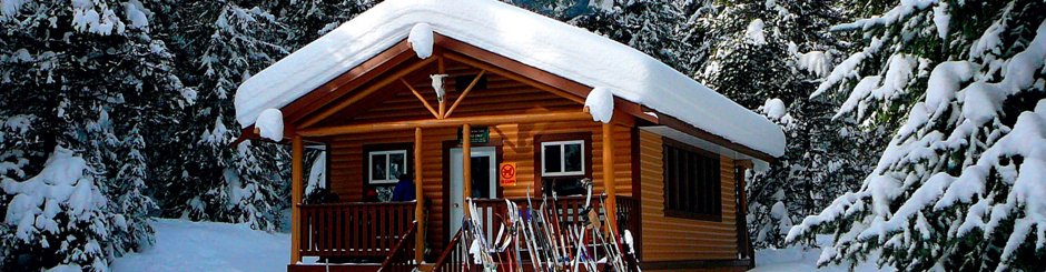
All levels of skiers and snowshoers are catered to. Dogs are welcome on all snowshoe trails and 21 km of ski trails. If the kids are bored, there is a toboggan hill for them to use, close to the main cabin. The cabin at the main trailhead and three other cabins on the trails all have wood stoves and toilets. These cabins are easily accessed by both skiers and snowshoers.
New club members enjoy free skate or classic lessons, while existing club members also qualify for a free skate lesson. Out of town visitors can make arrangements for a club member to accompany them on a tour (email ahead).
The club also hosts a variety of social events during the season, all of which are described on the web page. Come and give us a try; you'll be glad you did! Daily use contributions are $5 for snowshoers, $12 for skiers. Donation boxes are located at all trail heads.
Thank-you for your support.
The text above is verbatim from the Nordic Club homepage, as I figured that they could better describe themselves than I could. I'd like to add a few comments of my own however. First off, "the Google Earth and GPS tracks that are supplied on this site are those which I've created myself". I've been asked by the executive members of the Kelowna Nordic Club to provide a disclaimer staring that the Kelowna Nordic Club is under no circumstances responsible for the accuracy of these GPS and Google Earth file - as a basic insurance and liability statement.
As an experienced amateur cartographer, I'm 99.9% confident in what I've provided in the way of the xc-ski trails. The Snowshoe trails GPS files were provided to me by the club - and you need to be aware that they may not be 100% accurate - but all of the intended snow-shoe routes are properly flagged at this point in time.
As with every track and trail on this site; use your head out there. Take note of your surroundings and your own abilities. It's not a bad idea to review this "Snowshoing 101: What to Wear, Pack and Bring" link.
Finally. One of the many great things about this area as a whole is that it can be enjoyed as an all-season recreation destination. With it's massive xc-trail network acting as a summer playground, the immediate proximity to both the Kettle Valley Railway and Myra Canyon trestles 13.5km. north of Hydraulic Lake along the KVR, and the excellent paddling / camping zone at Hydraulic Lake.
We've paddled this area on several occasions and always loved the experience. The lake is very intriguingly shaped, offering all kinds of quiet crooks and crannies to investigate - and at the west end lies a 'puzzle-picturesque' meandering river. Paddlers will love it - highly recommended!
Average Elevation: 1275 meters | Length: +100km | Water: Some Potable | Cell Access: Mostly