

This trail is currently closed by the Ministry of Transport. They are storing hardware on-site that they don't want the public to mess with. As such, scratch this one off your must-see list. When it's reopened to the public, I'll be the first to let you know.
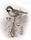
The height of land known locally as ‘Rattlesnake Mountain’ is one of nearly seventy throughout North America sporting that title. Despite extensive research, I cannot say who named the area, but given the mountain’s terrain and favorable exposure, I suspect that it hosts its fair share of Western Diamondback Rattlesnakes. Some among you may know the artwork of Allan Brooks (1869-1946) a world-renowned painter whose bird paintings are familiar to many. His work adorned publications including Keystone school exercise book covers, National Geographic magazine and many publications including ‘Birds of Canada’.
What does this have to do with trails on Rattlesnake Mt.? As a local resident, Brooks was fond of wandering the mountainsides, seeking knowledge and inspiration - and Rattlesnake Mt. was one of his local haunts. As you traverse the numerous singletrack trails on-mountain, you will see many of the same sights that he did in the early 20th century, and from which he gained inspiration. Glance at the right hand corner of this page for a sample of his work.
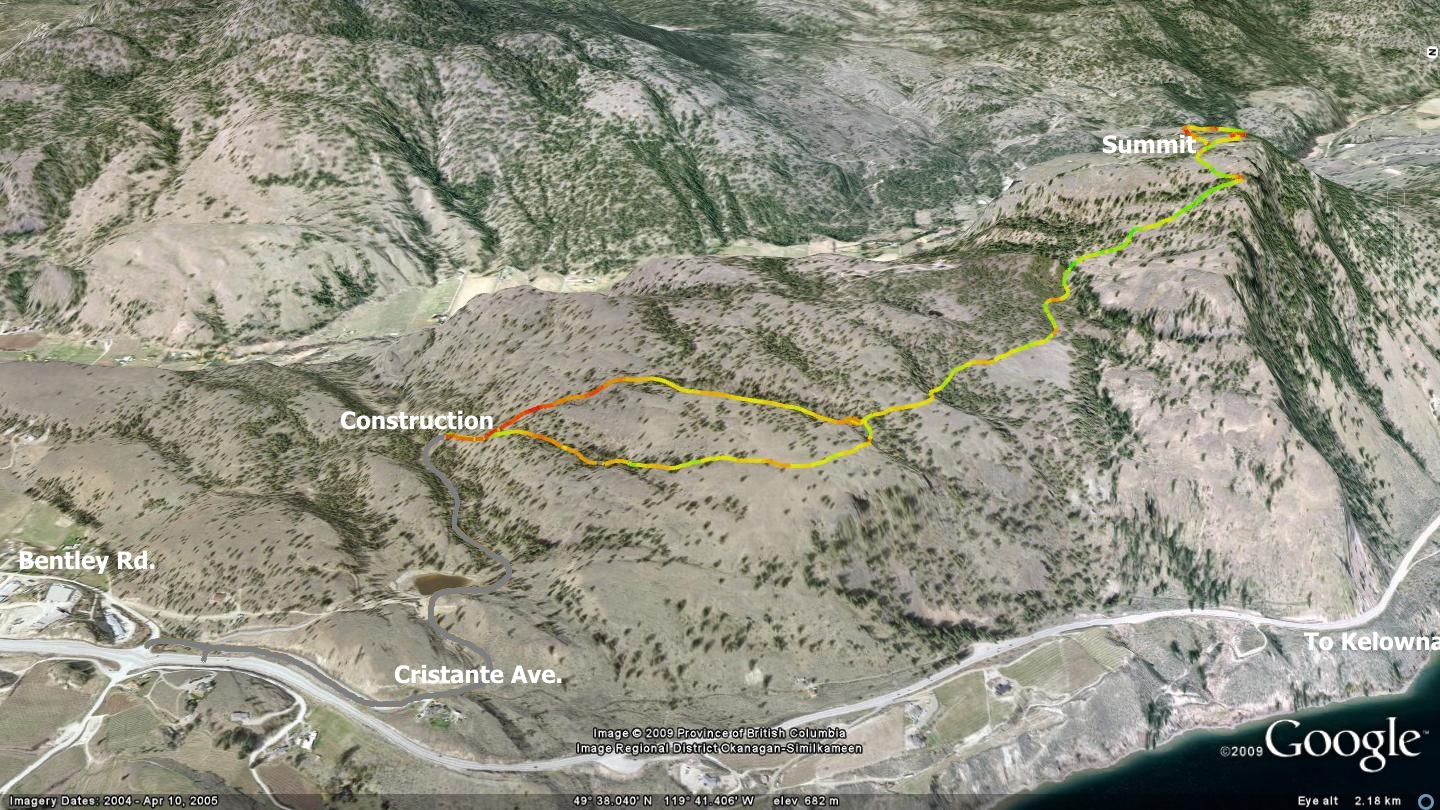
 The trails on-mountain are both fantastic and difficult. They are mostly in excellent condition, and lead to peaks with amazing views. Yet, they are difficult too, as there are several steep pitches enroute. Prior to the 2008 rebuilding of Hwy. 97 between Penticton and Peachland, the trail began at the dead-end capping Cristante Ave., located at the north end of Summerland adjacent to Hwy.97. Due to highway widening below, this area is now a massive construction zone. Neither the map accompanying this chapter, nor any other aerial maps that I am aware of, do justice to the current state of affairs. The area marked ‘Construction’ on this chapter’s map is currently a flattened area laden with heavy equipment (circa 2010).
Cristante Ave., indicated by the hand-drawn grey line on the companion map, has now extended a kilometer to the west via a wide, well-graded dirt road. This area is currently under heavy construction and several ‘no trespassing’ signs are evident. It is marked as such due to blasting and heavy equipment running up and down the main road from the area.
The entire area that hosts this trail is Crown land, confirmed through discussion with Summerland’s manager of engineering. A visual survey of what has been done with the land suggests that it may eventually be destined as a future subdivision, though nothing is being said about it at this time. This is due I suspect, to a local negative attitude toward development on or near Rattlesnake Mt.
As of early 2010, the area is still officially off-limits due to construction. Once the highway work below is completed, we can regain access to the Rattlesnake Mt. trails from the southeast face. The Rattlesnake Mt. summit is also accessible via a singletrack trail that ascends its northwest face, but one has to cross individually owned private property in order to do so.
When it becomes legally permissible to do so, seek access to the trailhead from the area marked ‘Construction’. From there, ascend a wide-track trail, the mouth of which appears on the north edge of what is currently the higher of two large plateaus of land.
Approximately 120 meters up the wide-track trail, you will find a singletrack that splits off to the right; here lies your first trail decision. Right heads to a beautiful piece of singletrack and the main, vista-filled route to the summit (which I refer to from now on as the ‘main trail’). Left ascends the wide-track you are on a further 100 meters before it sprouts another singletrack that also splits off to the right and heads for a sheltered valley. This sheltered valley trail eventually meets with the aforementioned main trail to the summit.
Travelled in either manner, you will soon find yourself at the junction where the two previously described trails meet. Ascend the well-established, northbound singletrack trail to the summit, which lies a short 1.7 kilometers away. Along the way you will face two or three slightly loose, steep sections, all negotiable, but in need of TLC. Feel free to do your part in its maintenance and improvement; switchbacks on the steep pitches would be great!
Rattlesnake Mountain’s summit provides you with a plethora of excellent views. A wander around the two mini-summits that constitute the main height of land allow 360 degrees of visual delight. Rattlesnake Mt’s location, coupled with its innumerable vantage points, must have made it a popular draw for many over the years. Note the accompanying image is rotated so that north is to the right. I did this in order to facilitate a better overview of the area.
Update; The main gate to the plateaus is currently locked to traffic from the end of Cristante Ave. Trail users must use an adjacent gate, located to the left, several meters back of the main gate across the road. Its 'fake-locked' and useable. This makes the journey to the trailhead slightly longer, but that's the way it is until the Crown reopens vehicular access; likely around the time that this area gains zoning for residential development. development.
Getting there Leave the Peach in Penticton and head north on Hwy.97 toward Summerland. Pass through the community as if you were on your way to Kelowna. Turn left on Bentley Rd. as you exit the north end of Summerland, and then immediately right on Cristante Ave.
Low: 592m | High: 917m | Length: 6km return | Water: none | Cell Access: Most areas