

Mt.Hawthorne offers a variety of routes to its peak. I will leave the others for you to discover on your own, but be aware that trespassing issues exist with some of the west face routes.
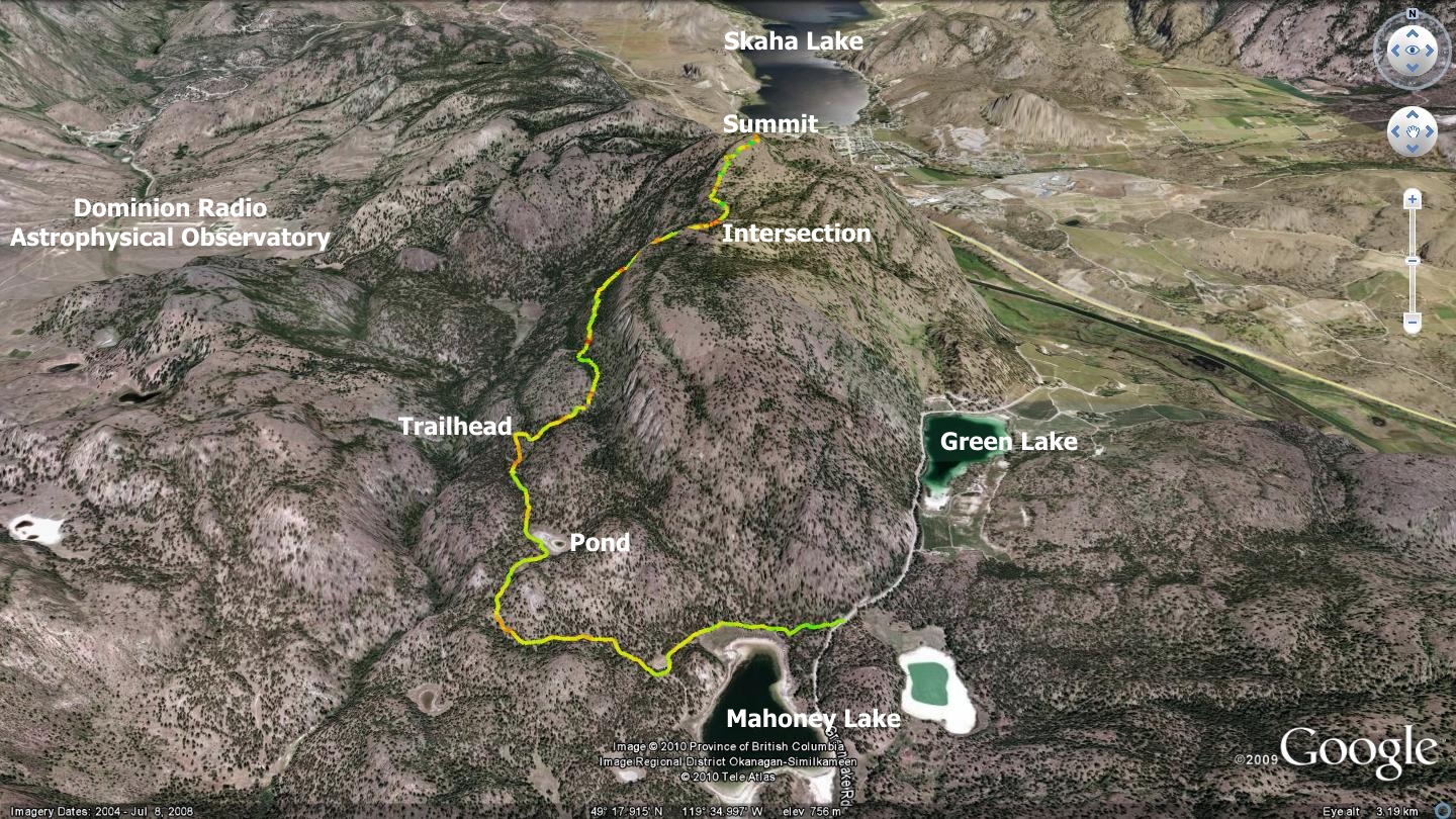
In this chapter, I will describe an ascent of Mt. Hawthorne via Mahoney Lake. The method follows the same entry as the Balsam Route trail, only it continues along the two-track beyond the point at which Balsam Route veers off-road to the right.
Park at the entrance to Mahoney Lake; a pull-off exists directly across the road from the gate. Follow west along the road toward Mahoney Lake. 750m along, you arrive at an information kiosk. Bear right and continue for 1km. There you will see a small pond (which may be dry). If you were to continue straight along your path, heading northeast, you would be starting up the Balsam Route; a trail described elsewhere in this publication. Instead, turn left and follow the road, making your way along the southwest shore for a distance of 775m. There, an obvious trail connects with the road on the right hand side.
Scrutiny of the trees reveals a round marker with a red cross on it, marking the trailhead of a route that leads to the summit of Mt.Hawthorne. 2.2km along this challenging singletrack, you find yourself at a well-marked intersection. Straight ahead leads to the summit of Mt.Hawthorne. Turning sharply right and ascending continues along the Balsam Route trail. This route is described in the Balsam Route chapter elsewhere in this publication.
The balance of the trail to the summit of Mt.Hawthorne is challenging, in both pitch and path finding. The Outdoor Club has marked much of it with rock cairns, but animals, people and the elements conspire to conceal many of these trail guides. Visit sweetsingletrack.ca to source GPS, Google Earth and printable maps which will assist with navigation. Mix this route with the Balsam Route or White Lake Loop to create an interesting exploration of the area.
Getting there From the Peach in Penticton, drive south on Winnipeg St. to Fairview. Take Fairview to the Channel Parkway. Go left on the Parkway to the lights at the Hwy.97 intersection. Take Hwy 97 toward Okanagan Falls; turn right onto Green Lake Road just before the bridge on the outskirts of OK Falls. Drive 7.5 kilometers until you see the entrance to Mahoney Lake and the yellow metal gate on your right hand side. Park safely off to the side of the road opposite it.