

Mt.Conkle, located in beautiful Summerland, hosts an interesting variety of dual and singletrack trail systems. Its regional park status, proximity to the rodeo grounds, Trans Canada Trail (TCT) and Kettle Valley Railway (KVR) Station make it a prime recreation destination. Consult the map above or this topographical map.
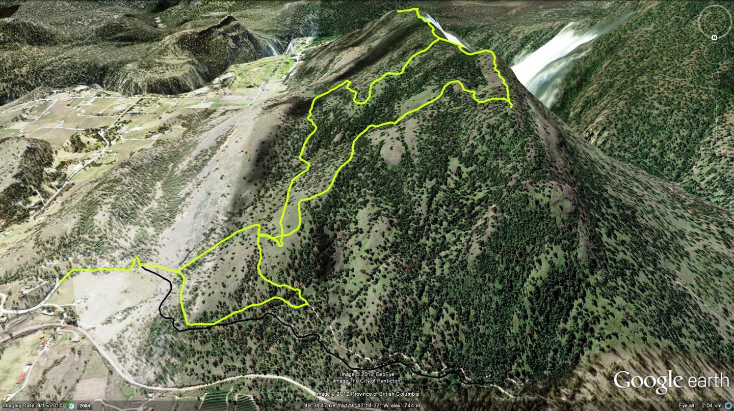
While most Okanagan sections of the TCT follow the old KVR line - sans tracks, here it cannot, due to the KVR steam train using the in-place rail lines for a commercial tourist operation. I'm really impressed with the area, its views and the complete lack of motorized recreation vehicles. While the active KVR line and TCT highlight the north face of Mt.Conkle, it’s the singletrack that I'm most interested in. The TCT, which runs parallel with the KVR line below it, is an excellent vector for access / egress to Mt.Conkle's singletrack trails.
One can enter the TCT on Mt.Conkle from either the east or west end. The west entrance offers a dedicated parking area adjacent to the Kettle Valley Steam Railway station and the Summerland rodeo grounds, located on Bathville Rd., west of Summerland. From there, head 3.1km south on the KVR to the trailhead.
This chapter focuses on the eastern entrance, due to its close proximity to the singletrack trailhead. This entrance is couched within a rural residential area at the end of Fenwick Rd. Road access to the general area is described below. Park near the information kiosk and head up the pavement, which ends and morphs into the TCT.
The TCT winds in and out of the forest before straitening, where, 50m along, a singletrack peels off to the left and rises - head up. Follow the singletrack until it meets an old two-track, follow the two-track and head up to the left again when it intersects with the Trans Canada Trail; ignoring the TCT. 300m along this secondary two-track, another trail joins on your left; this is the 'trailhead proper' for riders accessing Conkle's singletrack trails.
Your main focus is to locate the actual trail up; as opposed to the many ‘great looking’ singletracks which join prior to that point. The route described in this text is delineated by orange and silver arrow markers which border the trail at or near intersections; keep your eyes peeled enroute. Upon summiting, a two-track heads left, a singletrack right.
Left leads to view points, a nature preserve fence and dead-end 1.1km along. Right leads 1.2km to more vistas, a singletrack junction on your right, representing the trail back down and beyond it, a track dropping steeply down the spine of the mountain. The actual trail down is less signed only because intersections that one meets while dropping down the mountain generally head back up; as such, your DH route is obvious.
Take Victoria Rd. South, onto Simpson Rd., along Fyffe Rd., then onto Fenwick Rd. An info' kiosk denotes the TCT trailhead, park where convenient nearby.
Low: 589m | High: 913m | Length: 13km: | Water: None | Cell Access: Full