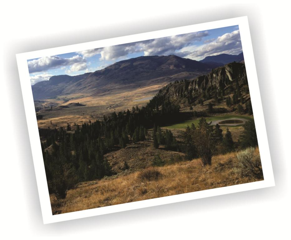
The Guy's Cache Trail, located within the White Lake Grassland Protected Area was created in 2013 as a dedication to a fallen friend, Guy Du Vent.
This circuitous route begins at a parking lot located 3.1km south of the Dominion Radio Astrophysical Observatory on White Lake Rd. The lot is situated exactly 20.3km. south of the Channel Parkway bridge at the south end of Penticton (intersection of Hwy.97 and Skaha Lake Rd.)
From the parking lot, the trail follows the Mahoney-White Lake Loop trail for a distance of 575 meters, where, nestled within a grove of aspens, a junction appears: the main trail heads left, while another heads right. The right hand junction is the entry/exit to the Guy's Cache trail, the left proceeds along the standard Mahoney-White Lake Loop, a trail which is described elsewhere in SweetSingletrack.ca
Two access points exist to Guy's Cache. One may enter the Cache' trail at this point, or continue along the Mahoney-White Lake Loop trail a further 245 meters, where, just shy of a fence/gate and BC Parks sign, a large pond appears on your right.
Don't pass through the gate. Exit the trail and head south (right) skirting the west end of the pond along a vague, meandering path through the sagebrush. Once at the pond, you'll see a trail in the distance continuing to follow the pond's shore on your left and a faint trail and several rock cairns turning away from the pond on your right, head right along the initially vague path.
Your route soon becomes much more obvious, ascending the mountainside and continuing to climb for 1.7km, where it reaches the first of three sub-summits. The trail meanders among the summits, each providing impressive vistas. The highest hosts a small, slightly hidden cache, with notepad, pencil and a ripple treat that could use a refill... The route soon heads west, then northwest as it descends to the intersection described in paragraph three.
The Guy's Cache trail is hike-only, due to its [many] steep pitches and tight switchbacks. Mountain bikers would detest it, and equestrians would find it far too narrow and tight.
The route passes through Nature Trust property down low and BC Parks at elevation. The Trail Alliance have applied to BC Parks to sign and sanction the route, but due to the fact that the trail was created 'on the sly' by a small group of individuals, BC Parks administration are hesitant to grant permission.
Land owners / managers are not at all keen on the "build it first, then ask forgiveness" nonsense - which I understand and support their position on.
In the meantime, please tread lightly on the land, staying on-trail throughout the route. If you see litter that some fool has discarded, please pick it up as it help us to keep this land as pristine as possible.
I strongly suggest that you take some time to download and thoroughly preview the Google Earth and / or GPS tracks for this route, available on SweetSingletrack.ca - at home.
You will find that having a classic, hand-held GPS with tracks loaded will be of assistance the first time that you are in the area. They are relatively affordable found used on eBay etc., and you should have one as a backup for trips anyway. Smartphones can be fragile and accidents happen.
Classic GPS devices (as opposed to smartphones) don't generally transmit, they usually only 'listen for' signals. As such, they are usually exempt from radio-frequency interference issues. If yours transmits as well; disable that feature or don't use that unit in this area.
Hope to see you out on the trails. Click on the image above to see the [big] version, looking northwest.
Special Note: This entire area is within the 'radiosensitive' zone monitored by the Observatory. Your smartphone must be set on 'Airplane' mode or better yet, switched off altogether while enjoying this area. This is important. If we anger the radio-frequency technicians, this NGO/protected-area trail will be rallied against and potentially closed to the public.
Our phones mess with the supersensitive radio frequency equipment at the nearby Astrophysical Observatory.
Final Note: Dogs. Leave them at home. There exists enough cactus near the start / finish that you won't want to bring them around this area anyway.
Vertical: 865m | Length: 6.3km | Water: None | Cell: Off
