

Glen Canyon Regional Park is set within an urban watershed created by Powers Creek. It is located along the southwest sector of the community of West Kelowna and features an amazing trail network. The overall canyon park is separated - split roughly 70/30 by Hwy.97.
While the upper section of Glen Canyon Park is currently a diamond in the rough, the lower section has recently been enhanced through the combined efforts of the Regional District of Central Okanagan and a local, grassroots group - the Gellatly Bay Trails and Parks Society. This chapter of SweetSingletrack.ca highlights the upper section of the two-part canyon trail network.
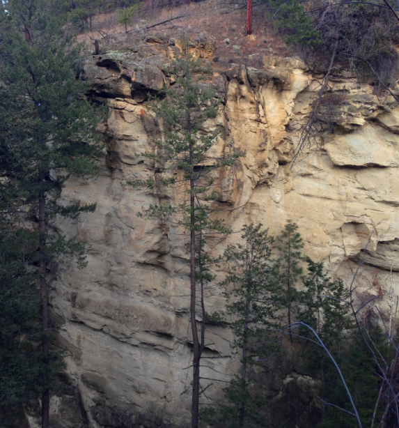
Unlike the lower section of Glen Canyon, the upper reaches are roughly maintained, which is to say, that despite obvious and easily traveled trails, there is just as much wild and woolly trail surface. This includes a couple of steep scrabbles up rock-faces, including one which is basically low-challenge rock-climbing. A section of river-bank land-slump adds to the trail’s challenge as well.
All of this is to say; you’ve been warned! I’d not advise taking a novice hiker on this route, nor a horse or mountain bike - if you intend to see it all in one pass. This is a route for able-bodied, experienced hikers only! Alternately, one could explore small sections of the upper reaches of this trail independently, as there are numerous entry points along it’s overall run.
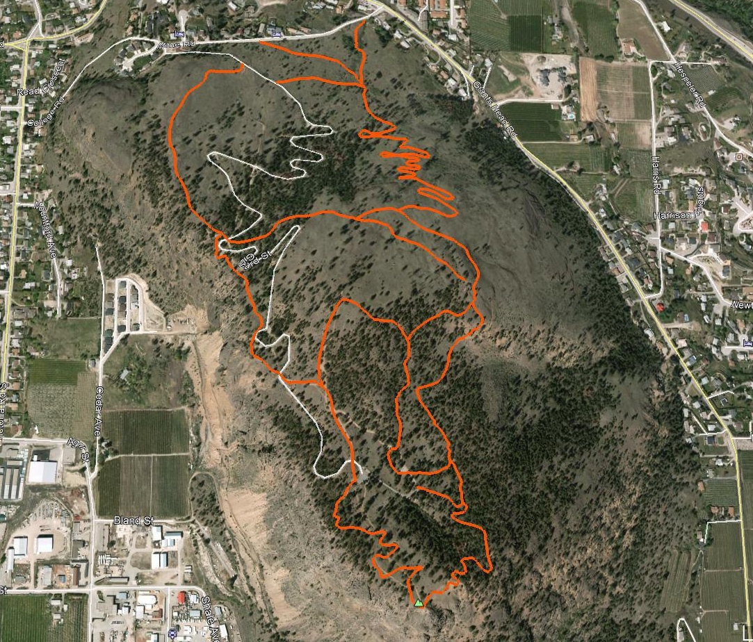
Egress / access is available via the following points (see map for reference): the North end of Webber Rd., 240m southeast on Coventry Crescent, the east end of Abertdeen Rd. and the bottom of the route, along Lower Glenrosa Rd. (the road which parallels Hwy.98.) The canyon change character as the watershed bears down on it’s terminus at Okanagan Lake.
The upper Glen Canyon section is heavily forested and more isolated in ambiance, the mid-section is rugged and steep, and the lower section offers amazing cross-canyon vistas somewhat akin to the hoodoo riddled clay-banks of Okanagan Lake. As opposed to that component of Glen Canyon Regional Park which lies below Hwy.97, the upper park currently lacks any modern boardwalks, staircases, bridging or trail-side cribbing.
It is my understanding that this will change in the coming years; the plan even included an ‘ultimate goal’ of a tunnel under Hwy.97, connecting the two sections of park! As you will see upon examining the Google Earth and GPS tracks which appear in the accompanying map as well as the downloadable digital files, there exist a great many parallel sub-trails up and down the banks of the canyon.
I advise that you stick with the main, lowest trail, unless spring high-water removes that option. The upper trails often lead into private property and present extreme side-slope trail-side.
Vertical: 144m | Length: 4.8km | Water: Not Potable | Cell: Patchy