

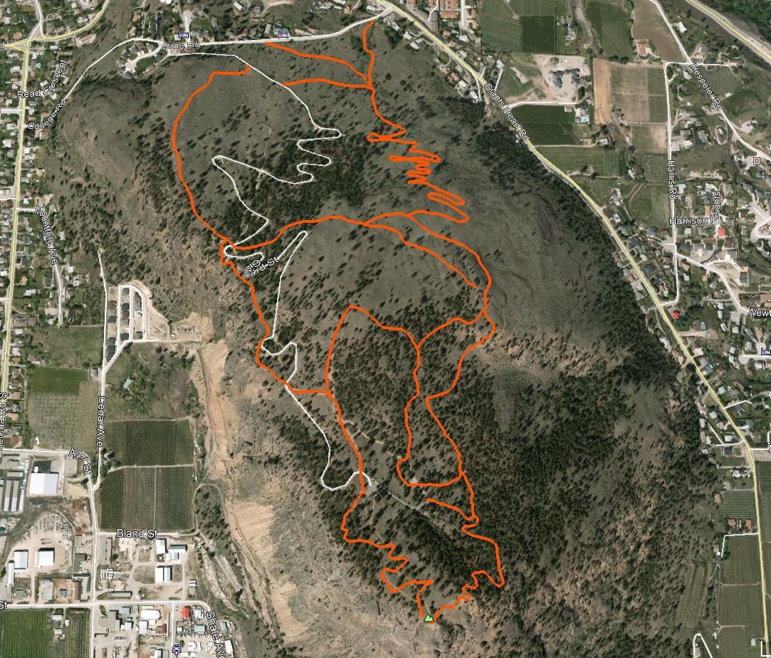
Giant’s Head Mountain, located near the heart of downtown Summerland, represents the epitome of singletrack convenience. This chapter provides an overview of the road to the summit of Giant’s Head, as well as one of several trails down. Man and beast have actively set upon this popular height of land over thousands of years - explaining the plethora of routes up, down and across its various faces.
An extinct volcano, Giant’s Head has become a roche moutonnée: a rock formed by the passing of a glacier. When a glacier erodes down to bedrock it can form teardrop-shaped hills that taper in the direction of flow. Through erosion, all sides and edges are smoothed in the direction of the glacier that passed over it with the exception of the jagged opposite face.
This rough face has been subjected to plucking - the process in which ice melts slightly by pressure, seeps into cracks in the rock and refreezes. As a result, the rock is attached to the glacier, which eventually rips it away from the landform as it continues its forward progress. The southwestern ‘plucked’ face of Giant’s Head is obvious from many areas of Summerland, but Victoria Rd. south and Cedar Ave. both provide good perspective.
The site at the mountaintop became Giant's Head Park during Canada's 1967 Centennial. A picnic area and washroom facilities were constructed, along with a time capsule to be opened in 2067. Gibbard Rd. is a 2.5km paved route running from Milne Rd. to the top parking area on Giant’s Head Mt. If riding to the top trailhead, I suggest you follow this paved route up, or convince friends to drive you to the summit.
Note that the accompanying map is rotated 180 degrees for a better overview of the trail. The summit and accompanying trailhead described in this chapter is located 60 meters above the top parking lot. Scout it’s southwest end where you will find a switchback trail leading to the summit.
The views from the summit are
amazing, one can see for great distances in nearly every
direction and all of it is gorgeous!
Those lucky enough to have been
driven up, or determined enough to have hiked or ridden
to the summit have several descending singletrack
options to choose from - both of the main ascent /
descent singletrack trails should be well-signed by the
time this missive is published.
Note that - by design,
unfortunately, there are no dedicated ascending bike
trails / aside from the paved road :-(
Both of the main routes up are far too steep, and the
switchbacks far too tight, to be anywhere near enjoyable
on a mountain-bike - - save for the uber-fit / 7%
body-fat crew.
The top-most singletrack entrance is
located off the east / northeast of the summit.
You can also pick up the same trail a little lower down,
just northeast of the restrooms at the upper parking
area. Another singletrack trail drops down
the north-northwest flank of the mountain, and is also
very steep in numerous sections; far too steep for
biking in either direction.
Getting There Make your way north up Highway 97 to Summerland. Turn left on Prairie Valley Rd., and follow it for 760 meters to where Giant’s Head Rd. meets it on your left. Turn left on Giant’s Head Rd. and follow it for half a kilometer to Milne Rd. Turn right on Milne and then left on Gibbard Rd. From here on in there is sufficient signage to complete the journey to the summit.
Elevation Gain: 293m | Length: Varies | Water: None | Cell Access: Total