A recent pair of treks into Kelowna’s Angel Springs has left me thoroughly impressed! Click the image above to see a large map of the area or click here to see a classic topographical map of same.
Unique forest canopy and canyon terrain, well-signed / maintained trails and decent parking at both entrances all contribute to making Angel Springs a destination not to be missed. Kudos for this trail paradise to both earth’s geology and the tireless work of F.O.S.S - Friends of the South Slopes (FOSS).
Foss’s volunteers are responsible for building and maintaining a cornucopia of trails along an apron of land cascading north from the summit of Little White mountain. Much of the trail network in this area is situated within Myra-Bellevue Provincial Park, which blankets the land in question.
Within it we find an awesome collection of interesting places to explore; Angel Springs, the Angel Springs trail, the KLO Cr. trail, Myra-Bellevue trestles, the Kettle Valley Rail-trail (aka; the Trans-Canada Trail) and the Crawford trail network described elsewhere in this publication.The two most common means of accessing Angel Springs are via;
- KLO Cr. trail, via a pull-off at a hairpin corner along McCulloch Rd.
- Angel Springs trail, from a designated parking lot located one kilometer up Little White Forest Service Rd., (FSR) measured from the cul-de-sac at the end of June Springs Rd.
Both of these options are described in this chapter. The area can also be accessed from above, via the KVR, but let’s hope that you are more interested in exercise than drop-shuttling the trail network.
While both the KLO Cr. and Angel Spring trails area are mountain-bike friendly, equestrian activities are not suggested, as the trails becomes very steep and lack space to turn a horse around on due to aggressive side-slopes.
As far as mountain-biking, both trails are intermediate to advanced. I suggest that you take to heart the brief sections which are signed onsite as "please walk your bike". The terrain in these zones is extremely erosion-prone. If riders destroy these sections, I have no doubt that we'll be banned from these trails!
The McCulloch pullout entrance finds one ascending a creek-side singletrack trail, followed by a brief section of an abandoned resource road, soon returning to singletrack as it ascends a regional park alongside and repeatedly crossing, KLO Creek.
The many bridgeless crossings on the KLO trail can be treacherous and wet early-season. I’d suggest using this route up to Angel Springs from July onward, after the snow pack has melted higher up the watershed. Please be aware that this route also presents a potential ‘death from above’ factor, as at one point you pass directly below massive cliffs, some hosting loose material.
The Little White FSR entrance is altogether different. One begins at the aforementioned parking area along the Little White FSR - which, but the way, also acts as the access / egress of the Myra Bailout trail, which enters from the nearby Crawford trail network. From this point forward, a well-signed 4km forest trail ascends to Angel Springs, featuring narrative plaques describing geological composition, history, local flora and fauna along the way.
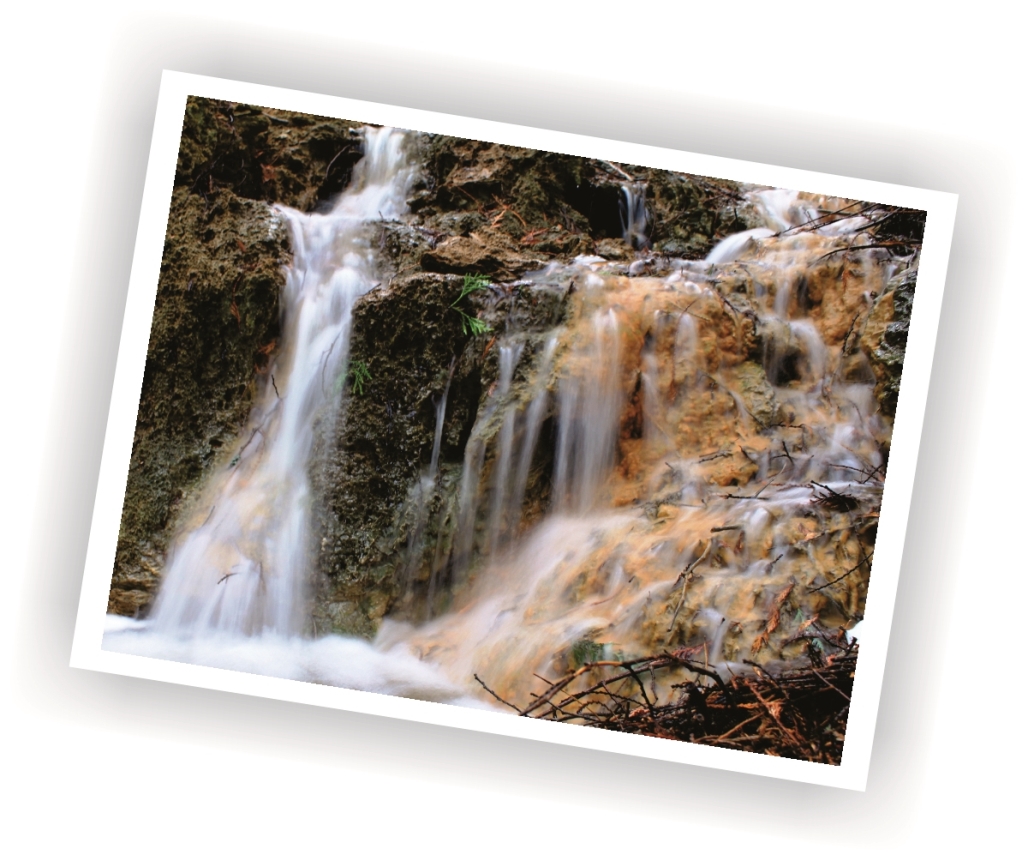
Although water below the surface is heated geo-thermally to over 100°c, the above ground springs are lukewarm at about 25°c and can be identified by large orange-colored tufa mineral deposits (crystallized calcite) that they have created.
To reach the Little White FSR trailhead from Kelowna, take KLO Road to McCulloch Road then to June Springs Road. Follow June Springs to the cul-de-sac at the end of June Springs Rd. From there, proceed 1km up the Little White Forest Service Road to a visually obvious parking area on the right. The June Springs trailhead is across the road from the parking area, up a few meters on the left.
To reach the McCulloch hairpin entrance pulloff, head east on KLO Rd. until it terminates into the three-way intersection of KLO / East Kelowna Rd. and McCullogh Rd. Head east on McCullogh Rd. for 6.5 Km. The right-hand pulloff representing the KLO Cr. trailhead is on your right at a fairly serious hairpin turn in the road.
Note that the distance shown below reflects the fact that getting into the area of the actual springs varies depending on which end you enter from. It also depends whether one decides to hike / bike the entire route - which I suggest you do at some pont. Its roughly 4km to the springs if one enters via the Little White FSR / Angel Springs trial, and nearly a kilometer longer coming in from the KLO Cr. side. The map is deceiving, as the Angel Springs trail is quite a bit twistier.
Low: 570m | High: 1086m | Length: Varies | Water: Not potable | Cell: Spotty
