


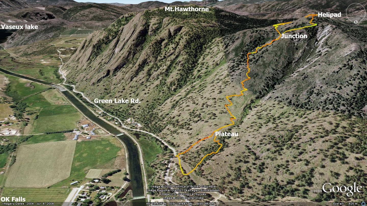
Climax (Upper and Lower) click on the map above to see a larger version
First came the ice-age, dragging sheets of 'everything' back and forth across what is now referred to as the Skaha Bluffs climbing walls. Afterward, wildlife meandered in and out of its narrow, steep canyon walls for thousands of years. First Nations people surely followed, and most recently the area has become a haven for folks who love to test themselves against gravity.
Twenty-plus years ago, I was introduced to the northernmost 'gentlest' section of the Skaha Bluffs by my brother-in-law, on mountain bikes. I’ve made numerous forays into the region over the years, but generally found that the disjointed maze of trails didn’t connect with one another very well; trails ran north-south quite effectively, but not so much east-west.
Recently however, someone has successfully connected the various trails in a long, lazy zigzag shape, employing descending ridgelines to link the north-south routes.
This has created an effective interface between parallel routes, exploiting durable rock trail surfaces to do so. I’ll describe the trail dropping through this ‘northern Skaha Bluffs’ zone as “upper” and “lower”, if only because it appears that two different parties created the route; one with red spray-paint, the other with a can of blue - with rocks of various sizes bearing witness to their choice of color.
You’ll need to keep your eyes peeled for said rocks, as south-facing painted rocks have been faded by the sun, and some rocks appear to be missing altogether; when it doubt, follow ridgelines, but be careful, as many of these represent the edges of significant canyons!
I’d advise you to download and follow the Google Earth and / or GPS tracks that I’ve added to the appropriate Google Earth and GPS track pages at SweetSingletrack.ca
Getting there: due to the fact that the top trail head begins at a remote point, [riders] have three main choices;
1) Ascent the Climax singletrack itself (for the uber-fit among you), beginning at the end of Evergreen Dr., and use the road just beyond the ‘chain-gate’ to the south, following the GPS track provided.
2) This is my recommendation, as it includes a warm-up route: begin from the end of Evergreen Dr., head north, following the provided GPS track, up the Sunflower Trail to the G-Spot trail. Ascend to the G-Spot summit, then ride off the backside (east face) and drop to the Fortis gas line service road. Head south along the gas line until you see the well-marked ‘red rocks’ exit on your left. This is the top trail head of the Climax trail. Technical / advanced bike handling skills are required beyond this point. Wearing light armour wouldn't be a bad idea.
Please don't cause a parking-access or noise issues while parking / departing from the end of Evergreen Dr., or this may bring about strife with the locals.
3) Park at the end of Wiltse Blvd, and ascend the gravel road until it meets the bottom of the G-Spot trail (study the Google Earth file). This is the most direct riders route for riders, but it doesn’t offer much of a warm-up ride; it simply plunks you down on the bottom of a slightly steep gravel road - and up ya’ go! It’s main benefit is that it offers a lot more parking then the end of Evergreen Dr.
Hikers may simply ascend the trail from the end of Evergreen Dr. - bottoms, up!
Low: 497m. | High: 760m. | Length: Aprox. 12.7 Km. | Water: N/P | Cell: Full